Southwest Wales and its Nature Reserves
Wildlife, landscapes and ecology
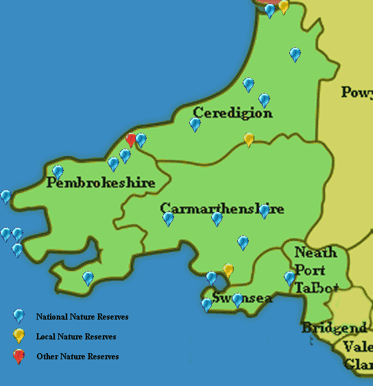
The regional divisions of Wales used on this website follow those adopted by Natural Resources Wales (NRW), the organisation with key responsibility for the designation and management of our Areas of Outstanding National Beauty, Nature Reserves, National Parks and countryside in general. To help you to locate nature reserves and other wildlife habitats, therefore, throughout this website 'Southwest Wales' includes the counties of Ceredigion, Carmarthenshire, Pembrokeshire, Swansea, Neath-Port Talbot and Bridgend.
Whilst Southwest Wales cannot rival North Wales for dramatic and rugged mountain scenery, the gentler rolling countryside of the southwest, with its spectacular coastline, the rounded hilltops of the ancient Preselis and the Cambrians, and long winding river valleys make it no less appealing and beautiful.
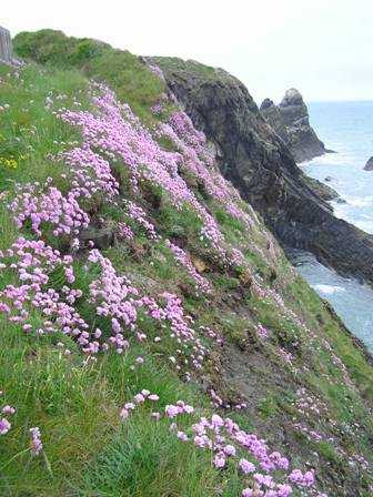
Below: Thrift blooming beside the Pembrokeshire Coast Path
This part of Wales is also home to some of our most-loved and significant nature reserves, sheltering great diversity of wildlife both in the sea and on the land. Pembrokeshire, in Southwest Wales, harbours one of Wales's three National Parks, the other two being Snowdonia National Park in North Wales and Brecon Beacons National Park in East Wales. The Dyfi Valley was designated as a UNESCO Biosphere in 2009, which underlines the importance of the species, ecosystems and landscape of this exceptional part of Wales and the commitment of the people who live and work there to preserve it.
The diversity of the habitats in Southwest Wales is a revelation. From the island of Skomer, with its fascinating bird-life and marine nature reserve (The Pembrokeshire Marine SAC is currently the only Marine SAC in Wales), to the Pembrokeshire Coast Path, the massive raised bog of Cors Caron, near Tregaron, the beautiful rivers (the Teifi, Tywi and Eastern and Western Cleddau rivers are SACs in their own right), the woodlands and hills, and the famous coastal nature reserves of Dyfi, Whiteford Burrows and Oxwich, there is so much to discover and enjoy. There are also many less well-known delights.
Tucked away in less-visited parts of the region, there are unimproved grasslands buzzing with insect life and home to rare and unusual plants, and numerous gentle walks through woodlands carpeted with bluebells in spring and dazzling displays of fungi in the autumn.
To spend time in Wales savouring its wonderful countryside and diversity of habitats is to understand how important these environmental assets are. We must maintain our focus on nature conservation and continue our commitment to protecting the landscape for the benefit of our wildlife and for enjoyment by future generations.
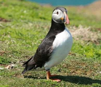
Below: Want to see a Puffin at close quarters? Visit Skomer!
The Southwest Wales Coastline and Islands
The Gower Peninsula
The Gower Peninsula was the first area of the United Kingdom to be designated, in 1956, as an Area of Outstanding Natural Beauty. Some 70 square miles in area, the interior consists mainly of farmland, but the coast has lovely coves and sandy beaches. Three Cliffs Bay and Langland Bay, as well as the larger beaches of Port Eynon, Rhossili and Oxwich are well known holiday destinations. The highest part of the Gower, at 633 ft, is the Beacon at Rhossili Down which overlooks the beach there.
Oxwich Bay is one of many nature reserves in the area. Like Kenfig, further east, the features include a calcium-rich dune system with dune slacks and saltmarsh, freshwater lakes and marshes, and adjacent wooded areas on limestone slopes. The wildflowers are outstanding there in summer, but there is much more to see at this reserve. Oxwich National Nature Reserve has its own page on this website, of course.
Pembrokeshire National Park and the Pembrokeshire Coast Path National Trail
The Pembrokeshire National Park is the only National Park in Britain that is truly coastal, a fact celebrated by its famous Coast Path National Trail. The inclusion of several offshore islands also adds to the Park's uniqueness. The landscape of the Park incorporates wooded river estuaries, wild inland hills and heaths, sweeping sandy beaches and rugged cliffs - truly something for everybody to enjoy.
The wildlife habitats in the National Park range from lowland heath to upland moor, ancient woodland, rocky and sandy shores, and estuary mudflats. The town of Milford Haven, which lies between the western and southern areas of the Park, has one of the finest deep-water harbours in the world. This is where the Eastern and Western Cleddau rivers, together with the little Cresswell and Carew rivers, enter the sea. There are six National Nature Reserves within the Park boundary, and many other designated sites that reflect the area's national and international importance for wildlife conservation.
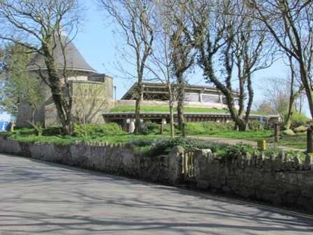
Below: Pembrokeshire Coast National Park Centre at St. Davids
The Pembrokeshire Coast Path is probably the best-known part of the National Park. Each year thousands of people travel to this part of Wales to walk either all or part of the Path. The entire length, some 300 kilometres, is managed by the Pembrokeshire National Park Authority. Organised public transport services collect walkers or drop them off at various points along the Path. There are two low-tide crossings at Dale and at Sandy Haven to consider, and knowing the timing of low tide will ensure that you avoid lengthy detours. The walking is not particularly strenuous, but there are many stepped ascents and descents, narrow sections, and stiles along the route making it unsuitable for prams or for wheelchair users. Otherwise, the Path is suitable for anyone who is reasonably fit.
You can find out much more by visiting the Pembrokeshire Coast National Park Centre at St. Davids (see picture on the right) which is open all year round. There is an information desk, a shop and also an excellent cafe which serves coffee, light lunches and afternoon teas. There is also a large car park in the road adjacent to the Centre.
Things to look out for on any walk along the Coast Path (although they could hardly be missed!) include the seabirds and the wonderful coastal wildflowers. The flowers start blooming early here. In February and March the Lesser Celandine (Ficaria verna) and Primroses (Primula vulgaris) arrive. Once these members of the advance party get established, the main party arrives in a veritable pageant of bright colours. The snowy white of the Common Scurvy Grass (Cochlearia officinalis) vies with the pale mauve of Spring Squill (Scilla verna) and the deeper purple of Bluebells (Hyacinthoides non-scripta), which are interspersed with bright Red Campion (Silene dioica) and, if you are lucky, some Early Purple-orchids (Orchis mascula) arranged against the dazzling golden yellow of the Gorse, with its delicious scent of coconut.
Hanging on to the cliffs themselves are multitudes of the Lemmings of the plant world, bright pink Thrift (Armeria maritima). Continuing with the military analogy, the rear party is no less exciting. If you are really observant you could see the diminutive Autumn Lady's-tresses (Spiranthes spiralis) on the well-cropped grassland of the clifftops; these orchids bloom from the beginning of August to September.
The Dyfi Biosphere
Dyfi National Nature Reserve incorporates The Dyfi Estuary, the dune system at Ynyslas, and Borth Bog (Cors Fochno) which is one of the finest raised peat bogs in Britain. Ynyslas sand dunes are the largest in the County of Ceredigion, and the Dyfi Estuary is home to countless numbers of wading birds and wildfowl. In the 1970s, Dyfi NNR was designated as a Biosphere, but in 2009 the area of designation was extended to include the whole of the Dyfi Valley, extending from Aberystwyth, Llandrynmair, Llanymawddwy, Corris Uchaf and Aberdyfi. This additional protection helps to preserve the genetic resources, species, ecosystems and landscapes of the Dyfi Valley.
Below: Grey Seal Mother and Pup

The Islands
Five important islands off the coast of Southwest Wales are protected as wildlife havens - Flat Holm, Skokholm, Ramsey, Grassholm and Skomer. It is possible to visit all five on a day-trip basis and, in some cases, to stay overnight in specially adapted accommodation. The boat trips are weather dependent and some of them need to be booked well in advance. Flat Holm, Skomer, Grassholm and Skokholm are most famous for their populations of rare and endangered seabirds, while Ramsey has the largest population of Grey Seals in southern Britain. There are many other aspects to the experience of visiting the islands that make for a thoroughly enjoyable and informative experience, and you will find more information about the wildlife and how to visit each of the islands on their dedicated pages on this website.
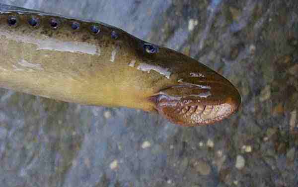
Below: The rasping jaws of a Sea Lamprey
Pembrokeshire Marine Special Area of Conservation (SAC)
Granted in 2004, the SAC designation for this part of coastal Wales recognises that the area is one of the best sites for marine wildlife in Europe; it protects a number of important habitats and the numerous wildlife species that depend on them for their survival. The particular habitats that are protected and for which the site was designated are estuaries, shallow inlets and bays, reefs, mud and sand flats, subtidal sandbanks, saltmarsh, lagoons and sea caves. The particular species listed in the designation citation are Grey Seals, Otters, Sea Lampreys, River Lampreys, Allis Shad and Twaite Shad and the rare plant Shore Dock (Rumex rupestris). These lists are significant for designation qualification purposes but in no way reflect the true numbers of habitats within the broad headings described above, or even begin to reflect the vast array of creatures and plants that live in the marine SAC.
Hills and Mountains
Preseli Hills
Inland from the North Pembrokeshire coast you will find the Preseli Hills, which rise to 1,758 feet above sea level at Foel Cwmcerwyn, their highest peak. Within the Preseli range there are numerous sites of archaeological interest, some dating back to prehistoric times. One such is the outcrop of rocks at Carn Menyn, which is the same kind of Preseli Spotted Dolerita or 'Bluestone' used in building the third phase of Stonehenge, around 2300BC. It is still unclear whether these stones, each weighing between two and four tonnes, were moved the 250 miles from Southwest Wales to Wiltshire by stong and determined men or as erratics carried along by the retreating glaciers.
Parts of the Preseli Hills have conservation designations (SSSI and SAC) to protect various species and habitats, and there are management programmes in hand to prevent coarse vegetation such as gorse and bracken from crowding out the more vulnerable rare species. Some of the special plants of the Preselis include Bog Orchid (Hammarbya paludosa), Pale Butterwort (Pinguicula lusitanica) and Marsh Clubmoss (Lycopodiella inundata). The rare insects include the Southern Damselfly (Coenagrion mercuriale) and the Marsh Fritillary Butterfly (Eurodryas aurinia).
Steep wooded river valleys and wild moorlands in the northern part of the Preselis come alive with colour when the heather blooms there in high summer. Ancient tracks weave a web across the landscape grazed by Welsh ponies and sheep; and overhead Buzzards and Kites wheel on thermals, hoping to spot unsuspecting small mammals that will make a nice lunch.
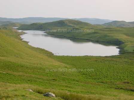
Below: Teifi Pools, the source of the River Teifi in the Cambrian Mountains
Cambrian Mountains
It was the Cambrian Mountains that provided the last safe haven for the Red Kite, Milvus milvus (Boda wennol, in Welsh, meaning the swallow-tailed hawk). By the 1930s the Kite population in Wales was so reduced that only a single female bird could be found, and that was in the Cambrians. Today anyone travelling through South Wales can nearly always see Red Kites soaring over the hills and valleys. If you aren't so lucky, there are a number of Kite Feeding Stations where at certain times of the day Kites (and Buzzards, too) are literally queuing up to be fed and photographed at close range.
The southern end of the Cambrian Mountains is in Ceredigion, and the rounded peaks can be seen rising up from the coast at Aberystwyth. During the series of ice ages that commenced around 2.4 million years ago, the Cambrians were covered in an ice sheet several thousand feet thick. When the ice retreated, around 12,000 years ago, we were left with the landscape with which we are so familiar today: a plateau dissected with deep clefts and river valleys carved by the action of the retreating glaciers.
As with the Preselis, the Cambrian Mountains are dotted with ancient features making them an archaeologist's paradise, but there are also a wide range of internationally important wildlife habitats. Within the mountain range there are more than fifty designated Sites of Special Scientific Interest (SSSI), and six European Special Areas of Conservation (SAC). By visiting some of the many nature reserves in the area you will see examples of blanket bog, areas of upland and lowland wet and dry heathland, fens, Atlantic oak woodlands, and wet (carr) woodlands with willows and alders. The numbers of species that make their homes in the Cambrians for all or part of the year are impressive: 35 mammals, more thyan 100 breeding bird species, 300 mosses and liverworts, 350 kinds of lichens, 450 flowering plants, 20 dragonflies and damselflies and 40 kinds of hoverflies. Many of the plants and animals found in the moutains are included on the Red Data lists of threatened and endangered species.
The SAC Rivers of West Wales
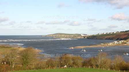
Below: The lovely Teifi Estuary
The Teifi, Towy, Eastern Cleddau and Western Cleddau
Sometimes referred to as the Queen of Welsh Rivers, at about 75 miles from source (in the Cambrian Mountains) to estuary (at Gwbert on the coast of Cardigan Bay), the Teifi is the longest river that flows for its entire length within Wales. Not only is its conservation importance recognised by the international designation of SAC (Special Area of Conservation) but it also passes through many sites bearing other conservation designations because of the importance of their habitats and wildlife.
The Teifi is different from most rivers that rise in mountains and then rush down steep slopes and through rocky gorges until they reach the lowlands, where they continue with a slow meander into the sea. Just a few miles from its source, the Teifi passes through the low-gradient landscape of Cors Caron, a large area of Active Raised Bog, which is an SAC in its own right and a National Nature Reserve. It is in the lower reaches that the Teifi hurries through some spectacular gorges before finally slowing down and passing through another major Nature Reserve, Teifi Marshes, just before passing through Cardigan and then on into the sea.
Like the Teifi, the 70 mile long River Towy also rises in the Cambrian Mountains, and it too is designated as a Special Area of Conservation (SAC). The Towy Estuary is at Llanstephan, some ten miles from Carmarthen.
The Eastern and Western Cleddau rivers meet at Landshipping Point, between Narberth and Haverfordwest. The Western Cleddau winds its way down from the north from its source in Llangloffan Fen, with the Eastern Cleddau joining from the north east, its source being just below Foeldrygarn at the eastern end of the Preseli Hills.
All four of these rivers have SAC status because of the presence of important species of fish. They all support populations of Brook Lampreys (Lampetra planeri), River Lampreys (Lampetra fluviatilis), Sea Lampreys (Petromyzon marinus), Bullheads (Cottus gobio) and last but not least, Atlantic Salmon (Salmo salar). In addition the Teifi, Towy and Cleddau rivers also have good stocks of Sea Trout (Salmo Trutta).
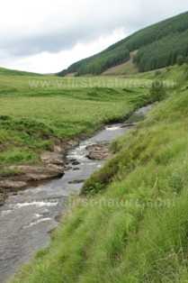
Below: High up in the Towy Valley
Interesting aquatic plants occur in these rivers including Stream Water-crowfoot (Ranunculus penicillatus ssp. penicillatus), Water Starworts (Callitriche hamulata and Callitriche obtusangula), and a rare aquatic moss Fontinalis squamosa. These rivers are also home to increasing populations of Otters (Lutra lutra), which find plenty of resting, feeding and in some cases also breeding spots throughout these catchments.
As well as Brook Lampreys, River Lampreys, Sea Lampreys and Bullheads, the Towy has an important spawning population of Twaite Shad (Alosa fallax) in its lower reaches. Good water quality in sufficient quantity is important for this internationally vulnerable species. The presence of Llyn Brianne reservoir some six miles below the source of the Towy provides a means of regulating the flow of water. In severe droughts the flow can be increased to assist fish migration - a vital factor in the survival of the Twaite Shad.
Llangloffan Fen, the source of the Western Cleddau, is another National Nature Reserve (NNR) and is one of the largest remaining floodplain or valley mires in Wales. This site supports a number of rare plants and is a haven for birds, insects, mammals and reptiles. In its eastern section Corncrakes (Crex crex), Quail (Coturnix coturnix) and Spotted Crake (Porzana porzana) have all been recorded in recent years. (Llangloffan Fen NNR has its own page on this website.)
Top of page...